Dr Melanie Biausque is a Coastal geomorphologist at the Geological Survey of Northern Ireland and lead for the Coast-R Small Grants Fund project, Co-creating Coastal Resilience. In this blog she asks, “How can we better understand the effectiveness of nature-based solutions while working alongside the communities who know and care about their coast?”
This question lies at the heart of the CO-creating COastal Resilience (COCOR) project. At Tyrella Beach, Co. Down, we are bringing science and local knowledge together to monitor coastal change and explore how citizen science can support the understanding and deployment of nature-based solutions.
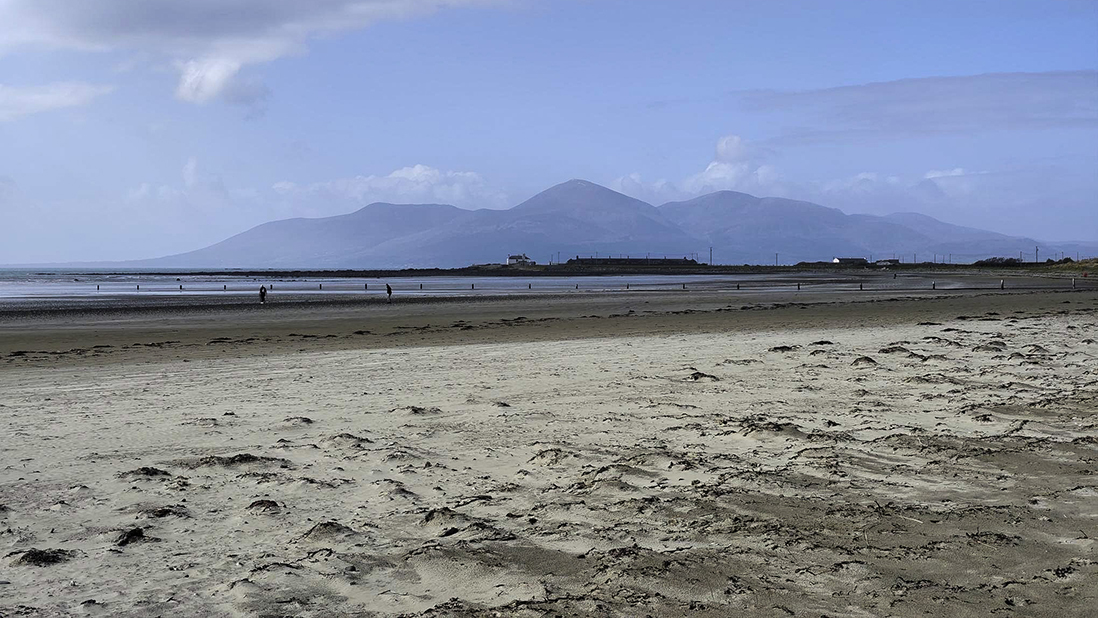
Tyrella is a 2 km-long, mostly sandy beach backed by approximately 25 hectares of mature sand dunes. In addition to their ecological value, these dunes play an important role as a natural buffer, helping to protect against coastal hazards such as flooding. However, a 2018 DAERA assessment found the dune system to be in an unfavourable condition, highlighting the need for improved management and restoration.
Since the initial assessment, nature-based restoration measures, including fencing, grazing management and dune grass planting, have been progressively deployed at Tyrella and continue to be undertaken. Yet no structured monitoring programme to understand how the dunes were changing over time or to assess the effectiveness of these restoration efforts had been implemented. The COCOR project aims to address this gap by combining coastal monitoring, community engagement and education.
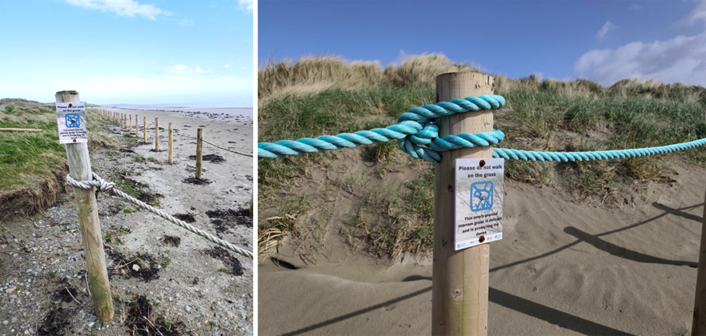
Monitoring coastal change together
Led by the Geological Survey of Northern Ireland (GSNI), in collaboration with Newry, Mourne and Down District Council (NMDDC), Mourne Gullion Strangford Geopark and the Department for Economy (DfE), COCOR has developed a low-cost monitoring programme that brings together scientific methods and citizen science.
The monitoring approach combines monthly differential GPS (DGPS) surveys, drone photogrammetry and shoreline observations collected through CoastSnap, providing complementary information on changes across the beach and dune system.
DGPS surveys capture repeated cross-shore profiles to monitor beach and dune morphology, alongside vegetation-line changes to track the development of the newly planted grass. Together, these measurements help identify hotspots of vegetation change and explore links with morphological evolution and sediment transport, particularly during winter.
Drone photogrammetry provides a wider view of the entire dune system, covering larger areas while minimising disturbance to newly planted vegetation. The imagery also allows different vegetation types to be identified and monitored over time.
Two CoastSnap stations were installed at Tyrella, marking the first in Northern Ireland to join this worldwide citizen-science network. By allowing beach users to contribute smartphone photographs, CoastSnap supports long-term shoreline monitoring and provides an opportunity for public participation that extends well beyond the COCOR project.
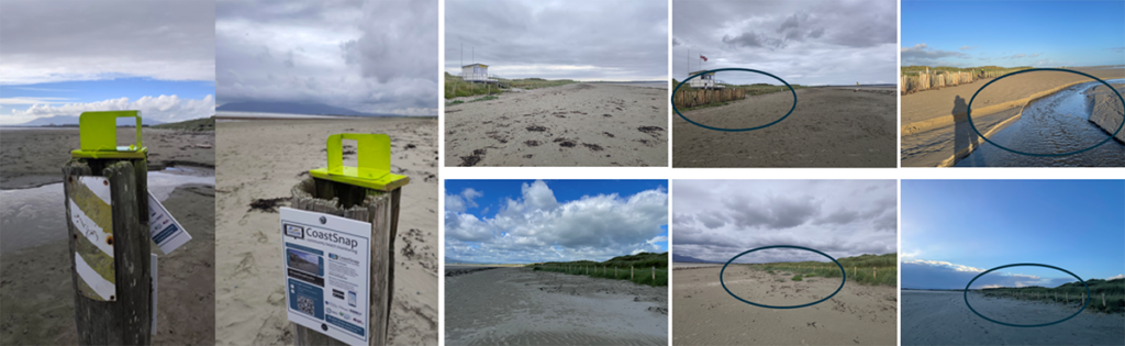
Alongside the scientific monitoring and citizen science, the project has worked to make coastal science more accessible through public events, educational resources and future engagement with local schools. The aim is not simply to collect more data. It is also to help people understand the coastal environment they know and love, become involved in the science, and contribute to discussions about the future of their coast.
Sharing COCOR’s work with the community
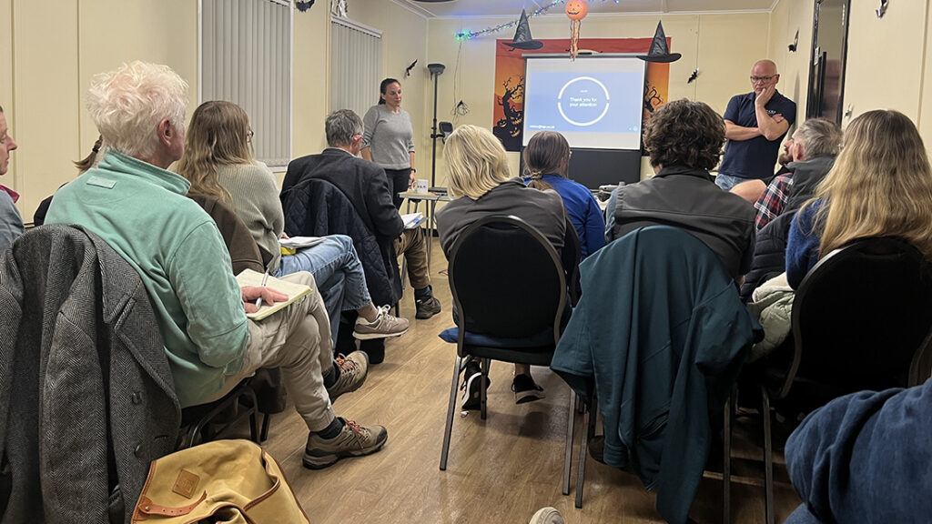
On 28 October, we brought together the COCOR project, the local community and the different actors involved in Tyrella’s dune restoration for a public closing event at Ballykinler, Co. Down. The evening provided an opportunity to present the work undertaken through COCOR, share preliminary monitoring results and discuss the project’s wider legacy. It also offered a chance to hear from others working at Tyrella and to explore how different strands of research and management could connect. The presentation highlighted the ongoing lessons-learned survey, inviting participants to share their experiences, and outlined how to access COCOR’s findings. Project outputs will be open access, with data made available through the DAERA Northern Ireland Coastal Observatory and updates shared via the GSNI website and social media.
One of the highlights of the evening was hearing about the wider ecological and environmental work taking place at Tyrella. Presentations showcased the diversity of research and management activities within the dune system, highlighting the importance of understanding its ecological as well as geomorphological characteristics. The discussions that followed encouraged the exchange of knowledge, identified shared interests and opened up opportunities for future collaboration.
Looking beyond COCOR: what comes next?
Although the COCOR project is reaching its conclusion, the work at Tyrella continues.
The coastal monitoring programme provides a foundation for understanding how the beach and dunes evolve, while continued CoastSnap observations and community participation offer opportunities to extend this work beyond the project’s lifetime.
The ongoing lessons-learned survey invites contributions from project participants and Tyrella beach users, helping capture a wide range of experiences and perspectives.
The findings will be brought together in a publicly available document, sharing lessons on citizen science, community engagement and coastal resilience to support future initiatives.
Ultimately, COCOR has shown the value of combining scientific monitoring with local knowledge and participation. By bringing people together around a shared coastal environment, the project has helped establish connections that could support future research, restoration and management at Tyrella and beyond.
Building coastal resilience is not just about understanding how our coasts change. It is also about bringing people together to share knowledge and explore how we can respond and adapt.
For further information about COCOR, project results or future updates, please contact Dr. Melanie Biausque at mbiau@bgs.ac.uk or visit the project web page.