
Dr Malachy Buck, Lecturer in Urban and Environmental Planning at London South Bank University examines the impact of uncertainty on planning in areas of coastal risk in this blog about his Coast-R Network Small Grant funded project.
The risks of coastal erosion and flooding are increasing across the UK. For example, in England, the latest NCERM2 modelling suggests that 3,500 properties are in areas at risk from coastal erosion up to 2055, though this rises to 44,500 if Shoreline Management Plans (SMPs) are not delivered. Comparable data doesn’t exist for coastal flooding alone, but evidence suggests by the 2050s around 30% of England’s ‘hold the line’ shoreline is likely to face pressure to realign, with implications for 120,000-160,000 properties uncertain of continued protection.
At the same time, there is a pressing need for many coastal areas to attract new development and investment, including regeneration, new housing and social infrastructure in places that often face significant socio-economic challenges. Balancing this pressure is a key challenge for planners and coastal managers.
Alongside my project co-lead, Dr Linda McElduff of Ulster University, our study focuses upon this issue, examining England and Northern Ireland. Northern Ireland has no formalised Shoreline Management Plan and a fragmented responsibility for coastal change. In England, SMPs offer a framework for adaptation, but their integration within spatial planning is varied.
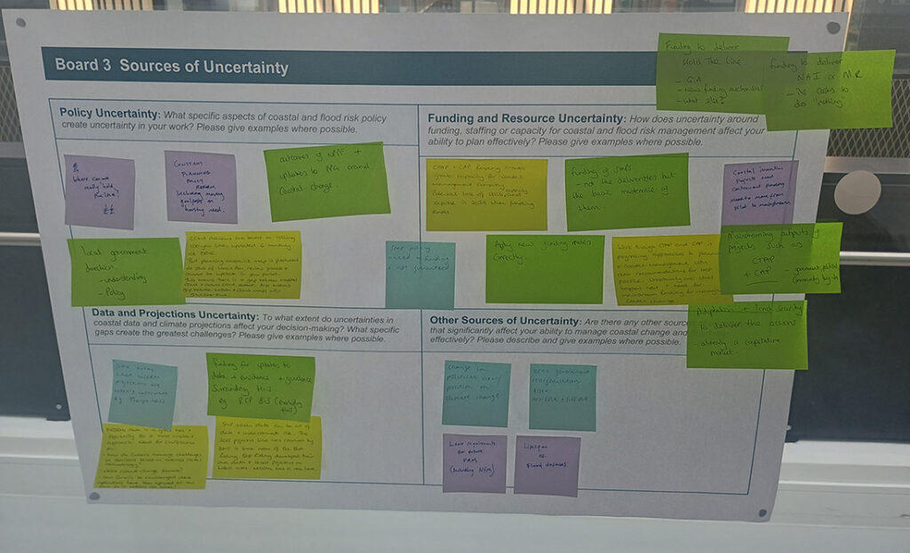
In June, we hosted two workshops with 27 practitioners and policymakers, in Belfast and in London. Participants came from coastal councils, research institutes, NGOs, alongside government bodies. Through scenario-based exercises, facilitated group discussion and thematic boards on which participants recorded and prioritised the issues they face, we generated a rich dataset together. What follows is a flavour of the themes emerging from that data and should be read as emerging themes rather than settled conclusions. We thank all the participants who gave their time to take part.
Realism of the challenge
At various points, participants noted that in theory we could (and arguably should) avoid approving development in areas under risk altogether. Yet, in practice, there is an equally real need for regeneration, new housing and social infrastructure which are vital to address the socio-economic challenges facing many coastal communities.
As one workshop participant put it:
“is it really realistic to say, okay, these erosion issues exist, but we just can’t stop development? This is in a designated town centre, there’s existing development, historical development. Are we really going to give that up?”
For example, in Northern Ireland, participants emphasised that economically important coastal sectors, tourism in particular, which drive jobs and growth locally need to be supported, and simply refusing development in areas which face longer-term risk often isn’t realistic. Similarly, participants in England pointed out that housing delivery targets create strong pressures to consider housing allocations in areas with long-term vulnerabilities.
Uncertain and absent policy frameworks
Policy frameworks across coastal management and planning should support planners in balancing these decisions. In England, there were concerns over the certainty of the delivery of SMPs, and the knock-on effect this has on planning decision-making. This uncertainty is compounded by the overlapping geographies, institutional complexity and a fragmented set of land and marine policy frameworks, whilst also considering a variety of other sectoral policies and frameworks beyond coastal management.
In Northern Ireland the picture was different, and a more fundamental challenge. Participants explained that with no primary legislation on coastal change, and no national framework for coastal management there was a governance gap. Without a statutory requirement to act, coastal change has not become a funding priority at a national or local level. Instead, piecemeal approaches are often taken, which can include unpermitted coastal defences being erected by private landowners.
In both jurisdictions planners are managing uncertainty, but not the same uncertainty. In England it comes from implementing an established, if imperfect framework. In Northern Ireland it comes from the absence of such a framework. However, the effect on practice is similar. In both nations planners are often left weighing long-term coastal risk against immediate development needs without the clarity that resolves them.
Mainstreaming what works
It was heartening to hear a wealth of good practice across the workshops, for example the use of CCMAs in Cornwall, East Riding and elsewhere. However, good practice was not always easy to share, replicate and implement. Participants described a clear need to better capture and share these practices across authorities so that effective approaches are ‘mainstreamed’ rather than being isolated examples. Similarly, it was seen that there is high-quality data on erosion (e.g. NCERM2 and Northern Ireland Coastal Observatory), but that the awareness and accessibility of this data may vary. The challenge is ensuring data and good practice reach decision-makers in a form they can act upon.
What next?
These are early insights from ongoing analysis, which continue over the coming months. A full report, including practical recommendations for planners and coastal managers, will be published later this year. If you would like to hear more, please take a look at the “Planning for Uncertainty: Building Adaptive Coastal Planning Capacity in England and Northern Ireland” project page or get in touch via email: malachy.buck@lsbu.ac.uk