
ABOUT THE PROJECT
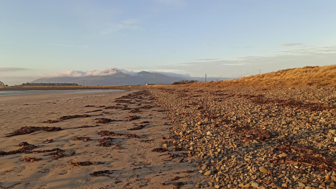
Tyrella Beach in County Down, Northern Ireland, is a 2 km sandy beach backed by 25 ha of ecologically important sand dunes within the Tyrella and Minerstown Area of Special Scientific Interest. Although restoration measures such as fencing, grazing, and dune grass planting have recently been implemented, geomorphological monitoring is currently lacking. This project will establish a coastal monitoring programme using RTK-DGPS surveys, drone mapping, and LiDAR comparison to assess dune change and the effectiveness of nature-based solutions. Citizen science tools, including CoastSnap, alongside community outreach and education, will support long-term monitoring while raising awareness of coastal processes and dune conservation.
PROJECT LEAD
Dr Melanie Biausque
Geological Survey of Northern Ireland
LOCATION:
Belfast, Northern Ireland
Project ACTIVE:
1 February 2026
Project Partners


Project Funders

The Challenge
Tyrella Beach in County Down, Northern Ireland, is a 2 km sandy beach backed by approximately 25 hectares of mature sand dunes that support a diverse and valuable coastal ecosystem. The site forms part of the Tyrella and Minerstown Area of Special Scientific Interest and has received both the Blue Flag Award and Green Coast Award for its environmental quality. Despite its protected status, a 2018 ecological assessment by the Department of Agriculture, Environment and Rural Affairs identified the dune system as being in an unfavourable condition, highlighting the need for improved management and restoration.
Recent restoration measures, including fencing, grazing management, and dune grass planting, have been implemented using nature-based solutions to stabilise the dune system. However, there is currently no structured monitoring programme to track geomorphological changes or evaluate the effectiveness of these interventions. This represents a key knowledge gap, particularly as coastal dunes play an important role as natural defences against erosion, storm impacts, and rising sea levels.
Addressing this gap is essential for informing sustainable coastal management. Establishing a monitoring programme and engaging local communities in data collection will improve understanding of dune evolution while increasing awareness of coastal change and the importance of dune conservation.
")
Our Approach
The project will establish an integrated monitoring and engagement programme at Tyrella Beach in County Down, Northern Ireland, designed to improve understanding of dune morphodynamics while actively involving local communities in coastal observation. By combining scientific monitoring techniques with citizen science and education initiatives, the project will generate new data on beach and dune evolution while strengthening local awareness of coastal change and climate resilience.
A structured geomorphological monitoring programme will be implemented to assess dune evolution and sediment dynamics. Monthly field surveys will collect high-resolution topographic data across the beach–dune system, enabling the detection of seasonal variability and storm-driven changes. These surveys will also allow comparison with existing baseline datasets to quantify long-term morphological change and assess the effectiveness of recent nature-based restoration measures.
Key elements of the monitoring approach include:
Monthly RTK-DGPS surveys to record cross-shore beach profiles and track changes in the position of the dune toe, timed with spring tide conditions and following significant storm events.
Drone-based surveys to generate high-resolution imagery and elevation data across the beach and dune system.
Comparison with the 2021 LiDAR dataset from the Department of Agriculture, Environment and Rural Affairs to quantify volumetric and morphological changes over time.
Community participation will form a central component of the project. A citizen-science initiative using CoastSnap will enable beach visitors to take standardised photographs of the shoreline from a fixed station, creating a crowd-sourced visual record of shoreline change. Volunteers will also contribute simple field measurements using existing fencing poles as reference markers to monitor vegetation-line movement and dune expansion or retreat.
Public events and school outreach activities will complement the scientific work by providing hands-on demonstrations of monitoring techniques and promoting responsible behaviour in dune environments. Through this combined approach, the project will generate valuable scientific data while fostering long-term community engagement in coastal stewardship.

